What this collection covers
This collection contains 25 distinct public camera addresses. The list below shows 25 selected views with their published locations, original operators and playback formats. The map opens the same collection, where you can search by name, narrow the country or type of place, save favorites and share a link to a particular camera. Coordinates describe the published camera location; they do not describe its direction or field of view.
25 cameras · 0 video feeds · 25 updating images. Catalog imported: .
Published camera positions in this collection span latitudes 33.596° to 33.740° and longitudes 130.584° to 130.731°. The directory includes 2 named operators or publishing hosts. These bounds describe the available entries, not continuous visual coverage of the entire area. Different cameras may look at the same landmark from different positions.
Selected webcams
Onga River Upstream Office
Location: Iizuka City, Japan. Coordinates: 33.7403°, 130.7311°.
Format: Updating image. Camera operator: cam.river.go.jp.
Open camera →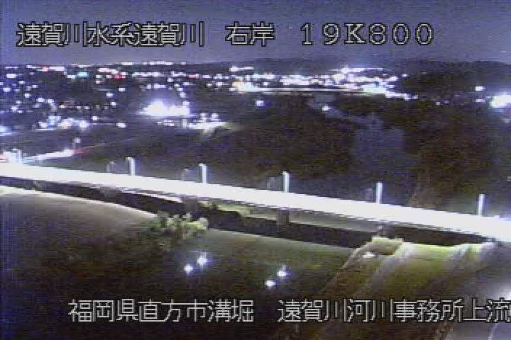
Yagiyama River, Miyawaka
Location: Iizuka City, Japan. Coordinates: 33.7112°, 130.6576°.
Format: Updating image. Camera operator: cam.river.go.jp.
Open camera →
九郎原トンネル入口(福岡側) (National Highway Route No.201)
Location: Iizuka City, Japan. Coordinates: 33.6003°, 130.6049°.
Format: Updating image. Camera operator: road-info-prvs.mlit.go.jp.
Open camera →
九郎原トンネル入口(飯塚側) (National Highway Route No.201)
Location: Iizuka City, Japan. Coordinates: 33.5965°, 130.6117°.
Format: Updating image. Camera operator: road-info-prvs.mlit.go.jp.
Open camera →
八木山1 (National Highway Route No.201)
Location: Iizuka City, Japan. Coordinates: 33.6219°, 130.5885°.
Format: Updating image. Camera operator: road-info-prvs.mlit.go.jp.
Open camera →
八木山10 (National Highway Route No.201)
Location: Iizuka City, Japan. Coordinates: 33.6420°, 130.6296°.
Format: Updating image. Camera operator: road-info-prvs.mlit.go.jp.
Open camera →
八木山12 (National Highway Route No.201)
Location: Iizuka City, Japan. Coordinates: 33.6425°, 130.6272°.
Format: Updating image. Camera operator: road-info-prvs.mlit.go.jp.
Open camera →
八木山4 (National Highway Route No.201)
Location: Iizuka City, Japan. Coordinates: 33.6256°, 130.5947°.
Format: Updating image. Camera operator: road-info-prvs.mlit.go.jp.
Open camera →
八木山5 (National Highway Route No.201)
Location: Iizuka City, Japan. Coordinates: 33.6424°, 130.6244°.
Format: Updating image. Camera operator: road-info-prvs.mlit.go.jp.
Open camera →
八木山6 (National Highway Route No.201)
Location: Iizuka City, Japan. Coordinates: 33.6425°, 130.6262°.
Format: Updating image. Camera operator: road-info-prvs.mlit.go.jp.
Open camera →
八木山7 (National Highway Route No.201)
Location: Iizuka City, Japan. Coordinates: 33.6396°, 130.6272°.
Format: Updating image. Camera operator: road-info-prvs.mlit.go.jp.
Open camera →
八木山8 (National Highway Route No.201)
Location: Iizuka City, Japan. Coordinates: 33.6403°, 130.6282°.
Format: Updating image. Camera operator: road-info-prvs.mlit.go.jp.
Open camera →
八木山9 (National Highway Route No.201)
Location: Iizuka City, Japan. Coordinates: 33.6412°, 130.6299°.
Format: Updating image. Camera operator: road-info-prvs.mlit.go.jp.
Open camera →
本村 (National Highway Route No.201)
Location: Iizuka City, Japan. Coordinates: 33.6264°, 130.6032°.
Format: Updating image. Camera operator: road-info-prvs.mlit.go.jp.
Open camera →
本谷高架橋 (National Highway Route No.201)
Location: Iizuka City, Japan. Coordinates: 33.6078°, 130.6294°.
Format: Updating image. Camera operator: road-info-prvs.mlit.go.jp.
Open camera →
津原橋 (National Highway Route No.201)
Location: Iizuka City, Japan. Coordinates: 33.6148°, 130.6482°.
Format: Updating image. Camera operator: road-info-prvs.mlit.go.jp.
Open camera →
福ヶ谷橋登板車線 (National Highway Route No.201)
Location: Iizuka City, Japan. Coordinates: 33.5988°, 130.6209°.
Format: Updating image. Camera operator: road-info-prvs.mlit.go.jp.
Open camera →
穂波東IC下り入口 (National Highway Route No.201)
Location: Iizuka City, Japan. Coordinates: 33.6232°, 130.6714°.
Format: Updating image. Camera operator: road-info-prvs.mlit.go.jp.
Open camera →
筑穂IC入口 (National Highway Route No.201)
Location: Iizuka City, Japan. Coordinates: 33.6006°, 130.6017°.
Format: Updating image. Camera operator: road-info-prvs.mlit.go.jp.
Open camera →
筑穂トンネル入口(飯塚側) (National Highway Route No.201)
Location: Iizuka City, Japan. Coordinates: 33.5999°, 130.5961°.
Format: Updating image. Camera operator: road-info-prvs.mlit.go.jp.
Open camera →
筑穂トンネル坑内1 (National Highway Route No.201)
Location: Iizuka City, Japan. Coordinates: 33.6056°, 130.5836°.
Format: Updating image. Camera operator: road-info-prvs.mlit.go.jp.
Open camera →
筑穂トンネル坑内6 (National Highway Route No.201)
Location: Iizuka City, Japan. Coordinates: 33.6011°, 130.5897°.
Format: Updating image. Camera operator: road-info-prvs.mlit.go.jp.
Open camera →
筑穂トンネル駐車帯上り (National Highway Route No.201)
Location: Iizuka City, Japan. Coordinates: 33.6019°, 130.5881°.
Format: Updating image. Camera operator: road-info-prvs.mlit.go.jp.
Open camera →
重原 (National Highway Route No.201)
Location: Iizuka City, Japan. Coordinates: 33.6392°, 130.6202°.
Format: Updating image. Camera operator: road-info-prvs.mlit.go.jp.
Open camera →
鎮西 (National Highway Route No.201)
Location: Iizuka City, Japan. Coordinates: 33.6432°, 130.6334°.
Format: Updating image. Camera operator: road-info-prvs.mlit.go.jp.
Open camera →
Webcams by country
- Online webcams · Japan · 13905
Explore by place and activity
- Beach webcams online · 13219
- Traffic webcams online · 122747
How to watch
Choose a camera to open its card, then start playback. Video begins only after your action. YouTube broadcasts and operator players open inside the viewer; compatible HLS and video streams use the built-in player. Image cameras refresh while the viewer is open and visible. The format selector separates video from periodically updated still images, so you can choose the experience you want before opening a view.
Reading a live view
A directory entry is not a guarantee that a camera is broadcasting now. Operators may stop a stream, change its address, restrict playback by region or publish a delayed image. The catalog import date is different from the time a frame was captured. When capture time is unavailable, the viewer says so. Check the time shown inside the original picture before drawing conclusions about weather, traffic or local conditions.
Questions about these webcams
Are all entries continuous live video?
No. Each row names its format. Video streams, embedded players and updating camera images are separate formats. Current availability depends on the original operator.
Can I save or share a view?
Open the camera on the map, save it to browser favorites or copy its link. The link opens that camera without starting playback automatically. Favorites remain in this browser.